

#navigation
Abandoned History: Oldsmobile's Guidestar Navigation System and Other Cartography (Part VI)
Sacrificing much, GM spent billions and billions of 1980s dollars on technology and engineering entities at the behest of CEO Roger Smith, who wanted to transform The General into a company more resembling a conglomerate like GE. Half a decade later Smith was gone, and the remaining brass began to unwind the costly EDS and Hughes deals and return GM to its standard operating procedure. But behind the layers of finance and paperwork, Guidestar GPS was developed. And the first time the public got to see it was in 1994 in a very exciting debut.
Abandoned History: Oldsmobile's Guidestar Navigation System and Other Cartography (Part V)
As we learned in our last installment in this series, the lowering of the digital and governmental barrier between civilian and military GPS assets in 1996 was a boon to the consumer side of navigation, and (per our comments) land surveying as well. It was a timely turn of events for General Motors after the Orlando area TravTek experiment of 1992 proved either too costly to scale, or alternatively not valuable enough in the eyes of consumers. Before we get to GuideStar, we need to cover much context around why GM was so keen on high-tech things in the Nineties, and the massive amounts of money it spent in its pursuit.
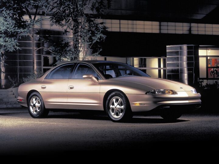
Abandoned History: Oldsmobile's Guidestar Navigation System and Other Cartography (Part IV)

General Motors spent a lot of time and money in the development of TravTek GPS. As we learned in our last installment, the comprehensive (if clunky) navigation system used a touchscreen, had live traffic information, and could even make phone calls. Installed in 100 Toronados used in the greater Orlando area for an entire year, GM, AAA, and various government parties were eager to see just how useful the system was and if it was worthwhile. Narrator: It wasn’t. Let’s find out why.
Abandoned History: Oldsmobile's Guidestar Navigation System and Other Cartography (Part III)
We return to our spicy Oldsmobile content this week, with the introduction of GM’s first publicly tested in-car navigation system, TravTek. Arriving in the early Nineties, TravTek was launched more than two decades after GM’s magnet-based DAIR prototype failed to make production. This time The General was determined to make good on their big investment. Onward, to Orlando!
Abandoned History: Oldsmobile's Guidestar Navigation System and Other Cartography (Part II)
In last week’s installment of Abandoned History, we learned about General Motors’ 1966 magnet-based primitive navigation system, DAIR. The inclusive system featured emergency messages, traffic bulletins played inside the car, and route guidance. DAIR never progressed beyond the concept stage and two total test vehicles, largely because it would have meant buried magnets and accompanying signal relay stations at every major intersection in the country. Some 25 years later The General tried it again, but technology progressed considerably by that point.
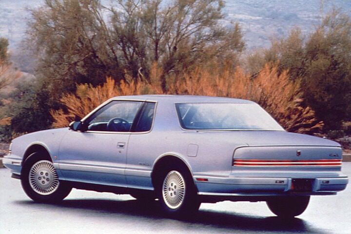
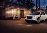
Abandoned History: Oldsmobile's Guidestar Navigation System and Other Cartography (Part I)
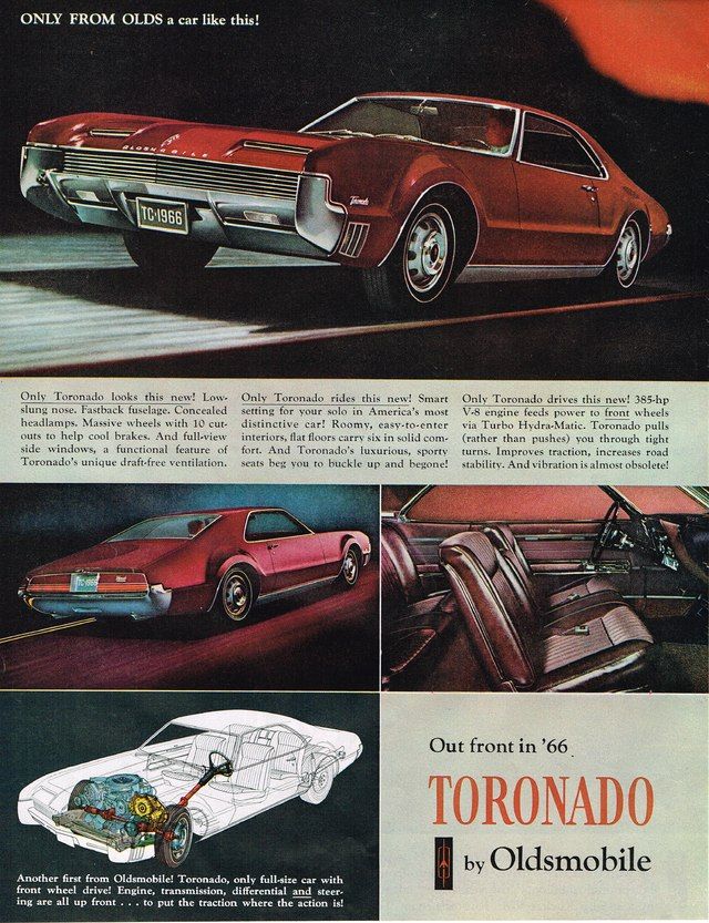
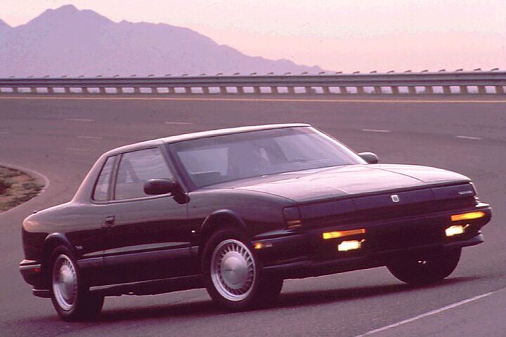
GM’s exclusive Guidestar navigation was available on a select handful of early 90s Oldsmobiles for a very short period of time. Gone as quickly as it arrived, the expensive system was at the forefront of in-car automotive navigation. Believe it or not, it was Oldsmobile that offered the very first navigation system for a passenger vehicle in the North American market. But what happened to Guidestar that led it to be featured here at Abandoned History? The tale begins in 1966, with a genius idea.
Renault Launches Built-In Waze App for France, Interested?

Waze has become an incredibly popular navigation tool for drivers, growing from just a few thousand users in 2008 – back when it was still called FreeMap Israel and Linqmap – to a whopping 140 million monthly active users spread across 185 countries by 2022. This surging popularity has been attributed primarily to Waze offering features that allowed drivers to share travel details that would be of use to other drivers, pinning things like the location of speed traps, wrecks, and construction, or simply helping the application estimate route times. But it’s only ever been a mobile app that can be mirrored to your dashboard – until now.
Noting that Waze is the most commonly used driving application in France, Renault has partnered with the company to deliver a dedicated version of the app for its vehicles.
QOTD: Trouble Finding Yourself?

Listen, we don’t want to hear about that summer after high school… unless it involved a road trip requiring precise and detailed navigation!
That’s right, today we’re talking about finding one’s way through life in the most literal sense. Charting a course. These days, reaching your destination usually involves a pre-programmed route, satellite linkup, and a detached female voice ordering your every move, barking commands at every turn.
Do any of you still hang on to the old ways?
QOTD: Is There an App for That?
At the risk of sounding like any number of insufferable site fully staffed with dough heads who spend way too much time extolling the virtues of kale (is kale still a thing?), our question today is about driving and car-related apps.
While backing up his phone this weekend (I can’t bear to lose those all important notes about used cars that have been long sold, don’tcha know), your author was struck by the amount of space on his phone being consumed by items relating to cars.
Hackers Do the Dirty to Another Tesla Model 3

It’s Elon Musk’s birthday today, so we’ve decided to wish him well and say congratulations on Tesla Motors convincing the U.S. Commerce Department to waive the 10 percent tariff on imported aluminum so it can build more battery cells at the company’s Nevada Gigafactory. However, what would birthday well-wishing be without the all-important pinch to grow an inch?
Another Model 3 has been hacked, this time without the manufacturer’s blessing. We’re equating it to a mild goosing. Regulus Cyber, a company specializing in digital security, decided to give the Tesla (and a Model S) a shakedown by seeing if they could fool the car’s navigational equipment and upset/confuse Autopilot to the point of failure.
Let’s see how they did.
Jaguar Land Rover's 'Hot' New Idea: Sensory Steering Wheels
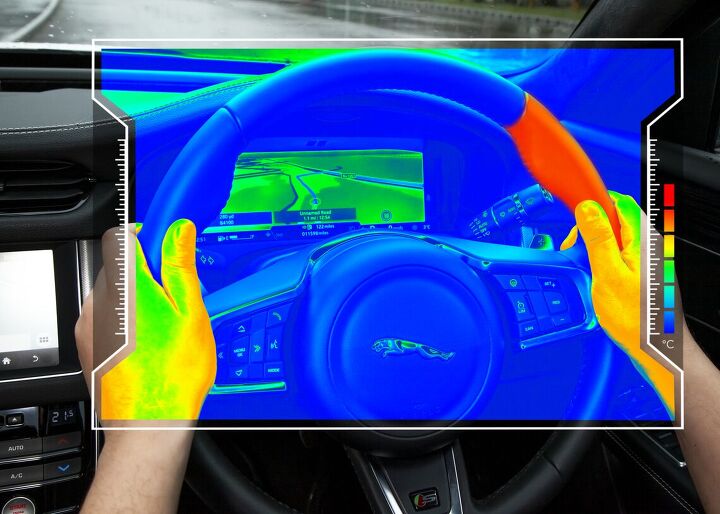
With automakers perpetually promoting daft new technologies as a way to appease investors, it’s been a while since we’ve seen a new idea that made us take pause and wonder why nobody else had come up with it first. Fortunately, Jaguar Land Rover has done us a solid, with research help from Glasgow University, and delivered a “sensory steering wheel” aimed at giving drivers silent feedback through temperature variances.
The applications of the device are yet to be settled upon but JLR has suggested that the wheel could be used to notify the driver of less-pressing issues that don’t warrant an audible announcement or even offer silent turn-by-turn navigation.
Google Maps Finally Tracking Speed Limits, Speed Traps
The next time you use Google Maps to plan a road trip, you might notice some changes. Maps is now providing live updates on posted speed limits across the United States. Previously, this feature was only available in San Francisco. However, other parts of the country started seeing the feature crop up late last week as Google updated local servers.
This author saw changes on the app as early as January 18th. Travelling a bit too far from major metropolitan hubs or major highways has proven coverage has not yet gone nationwide. Google says it hopes to soon remedy that by implementing the service across the United States, United Kingdom, and select parts of mainland Europe. Of course, if you don’t want to wait, Waze (also owned by Google) has had this feature available for years, and remains the more robust navigation platform.
Safety Advocates Getting Testy Over Automotive Apps, Consumer Data

Automakers began hunting for new revenue streams about two milliseconds after realizing they could put the internet into vehicles. While the earliest endeavors involved ride-sharing applications and new infotainment features, companies are now beginning to see new opportunities via automotive e-commerce, data acquisition, and in-car marketing.
However, the delivery system used for these new sources of revenue pose a legitimate safety concern. Distracted driving is on the rise and shopping while behind the wheel isn’t likely to remedy the situation.
Volkswagen GTI-Themed Waze App Steers You Toward a Good Time

Our personal biases frequently lead us to condemn any number of advanced automotive technologies. That’s partly because we’re dinosaurs who fetishize vintage automobiles that, in reality, are actually far worse than we like to pretend. But it’s also because most modern-day tech sucks harder than a jet-powered Dyson. A large portion of that problem stems from automakers implementing technology solely to appease regulators or line their pockets with cash.
Fortunately, this isn’t always the case. You sometimes end up with things like power windows, torque vectoring, the dual clutch transmission, and satellite navigation. And while it’s still handy to know how to read a map, GPS has made car-based voyages a breeze, and it’s only getting better.
Waze, a preferred navigation app for many, offers community-confirmed accident information, fuel pricing, and speed traps. Since its purchase by Google in 2013, the system now finds itself baked into Android Auto. Things are progressing rather nicely, as a new partnership with Volkswagen implements features that cater specifically to driving enthusiasts.
Apple Rebuilding Maps App, Hopes to Outperform Google

Apple Maps has been a lackluster tool for navigation since its launch. Of course, you probably don’t know this because you’re statistically more likely to back out of the driveway using Google Maps or Waze. That’s because the latter programs seem to work as intended. The same cannot be said of the former.
While Apple can get you down a major highway without incident, it frequently falls apart when you start asking it to make sense of a complex, overlapping network of roads or sparsely traveled rural area. Meanwhile, Google has already mapped the same areas twice and taken photos of every blade of grass within 100 square miles.
Upon launch, Apple Maps was plagued with issues. Areas were left blank, locations were misnamed, landmarks were misplaced. Had it come out a decade earlier, it’d have been a technological marvel. But with competent competition readily available, the iOS-based navigation system was (and remains) unacceptable. So Apple is giving it a complete overhaul.


Recent Comments