

Dead Tree Maps Aren't Dead Yet

With fall foliage peaking, it’s time for my third annual Appalachian Road Trip. Last year my friend and his father couldn’t make it, so it was just the old man and me. With fewer time constraints, I planned a route from West Virginia to “The Dragon” and back. Lessons were learned, among them the insanity of planning 360 miles of back roads driving in a day that also includes a few hours of hiking (my new max: 250) and, the subject of this piece, the inability of navigation systems to replace good old paper maps.
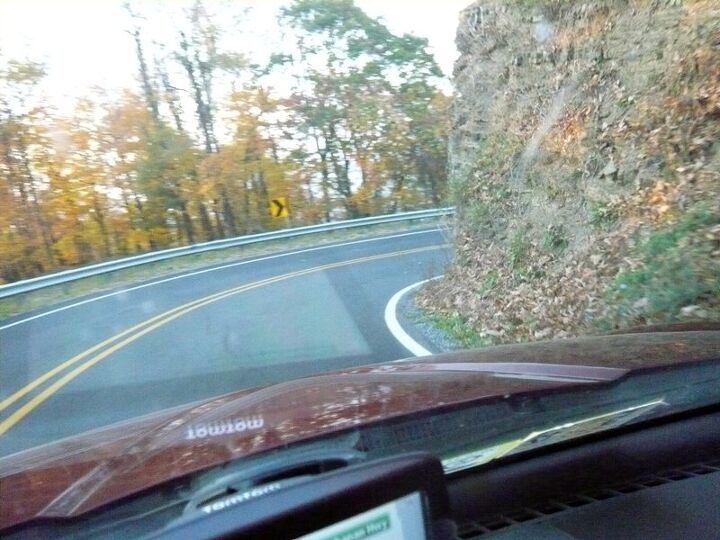
Does it wind through 60 degrees, or 160? How tightly is it wound? Does another curve closely follow it? With these questions answered, the 318 curves in Tail of the Dragon pose little risk, even at night. (You ride The Dragon at night when things don’t go quite as planned.) Without these questions answered, bad stuff can happen.

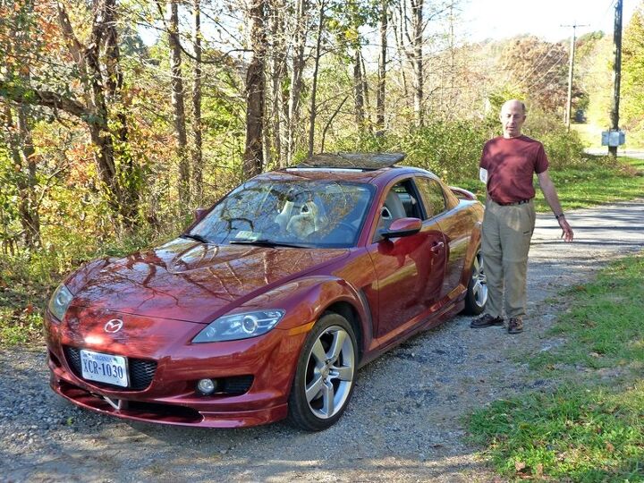
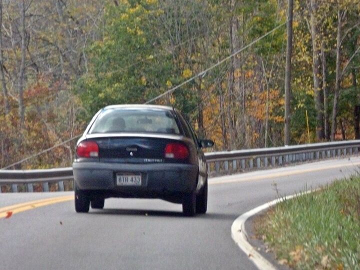
That incident in mind, and in a new(er) RX-8 we wanted to keep on the road, the old man picked up a TomTom on the way out of town.
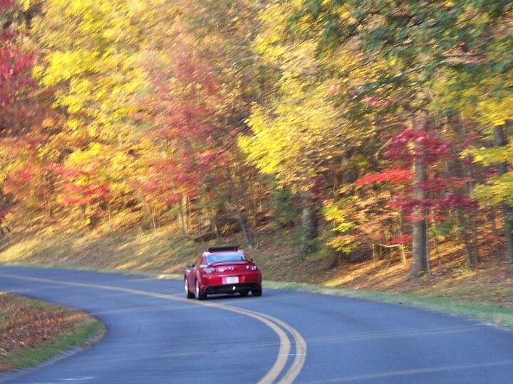
Like pretty much any other nav system, the TomTom would have done a fine job getting us to our destination if we simply wanted to drive as little as possible. But for driving enthusiasts, the trip is at least as important as the destination. You can’t instruct the TomTom to maximize the number of curves or the beauty of the scenery. Using Google Maps, I scouted out the twistiest roads connecting Lewisburg, WV, to Asheville, NC (a waypoint coming and going).
Some navigation systems can download a Google Maps route. But where’s the adventure in that? Lewis and Clark didn’t have a machine telling them when to turn. (They did it the old-fashioned way: they had a woman telling them when to turn.)
Well-travelled roads tend to be well-marked. The back roads in northwestern North Carolina are neither. When there is a sign at all, it might have a number when you’re looking for a name, or vice-versa. We got lost in this area on the way down, AND again on the way back. This wasn’t entirely a bad thing, as those roads have more curves than straights, and the views are outstanding.

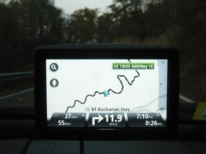
But when you’ve covered the same stretch of road three times in an hour, that’s enough. Help is needed. But not too much help. All I really want to know is where each road goes when I arrive at an intersection. But minor roads only show up on current navigation systems when you zoom in so far that you can only see a mile (at most) down them. Which you can pretty much do without the nav system. I’d LOVE an option to display minor roads even when zoomed out. This wouldn’t be viable in urban areas, given the density of the grid, but in the MOFN it’s a different story.
We eventually threw in the towel and programmed the nav to take us to the next town along our route, Marion. The TomTom took us in the opposite direction than that suggested by my gut, retracing the route we’d just driven. Having surrendered to the machine, only after 20 minutes did I firmly conclude that something wasn’t right. Guess what? There’s a Marion in North Carolina as well as one in Virgina—and when programming the nav I hadn’t specified the state. We ended up retracing our route yet another time. If there weren’t ruts in those roads when we arrived, there were by the time we left.
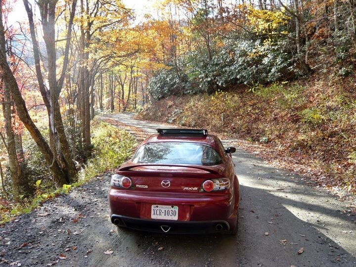
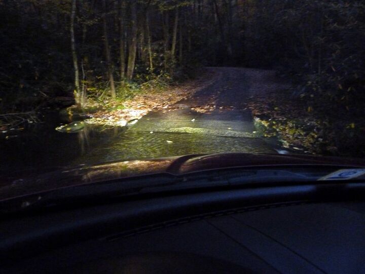
Did I mention that many of these roads were gravel? Any decent paper map codes roads based on type: red lines, double red lines, blue lines, gray lines, dotted gray lines, and so forth. You can tell if the road spans two lanes or more, and whether it’s paved, well-graded gravel, or best traversed by truck. Neither Google Maps nor any nav system I’ve encountered conveys this information. Outside metro areas and off the highway, even roads that start out paved can turn to gravel—or worse—at any time.
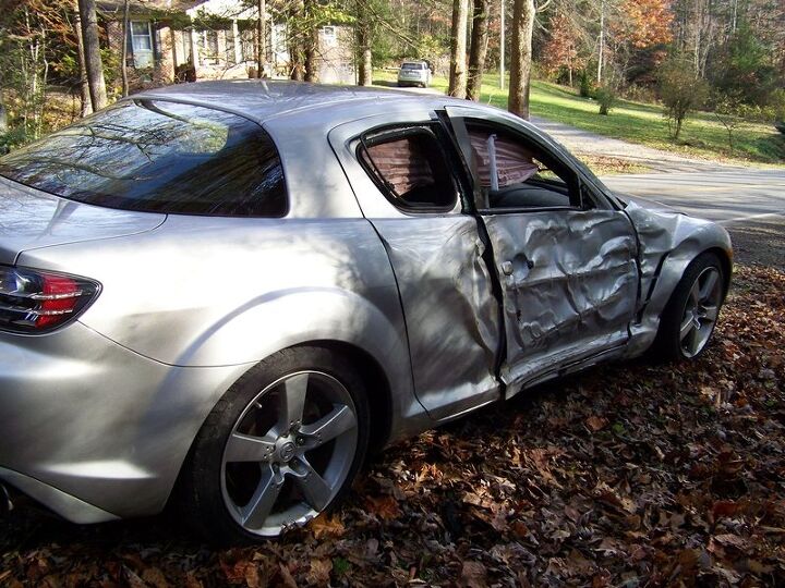
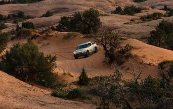
And often do. On the single-lane dirt road we took to The Dragon (Parson Branch, not the conventional approach), we had to wait about ten minutes while a pickup repeatedly attempted to ascend an all-chewed-up hill. Luckily, as sports cars go the RX-8 has a compliant suspension and decent ground clearance. Plus one thing that pickup didn’t have: 50-50 weight distribution. Once our turn finally came, we summited on the first attempt. I don’t think our heads hit the headliner more than three times, and both car and occupants survived the experience without permanent damage. A few inches of water flowing over the road? Also not a problem.
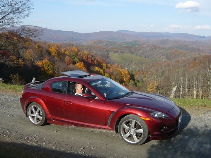
Good thing, as there’s no turning around on Parson Branch. It’s not only one lane, it’s also one-way. Once you begin it, you must finish it! The Mazda RX-8, already the go-to car for a trip like this one due to its combination of visibility, agility, balance, composure, predictability, feedback, ride quality, space for your stuff, and disposability affordability, is now officially Parson Branch-Rated(TM). How many Porsche sports cars can make the same claim?
Once back on a (relatively) well-traveled mountain road, there’s a different class of hazard. Not everyone’s driving as if the curves have been provided for entertainment purposes, and the passing zones are few and brief. Blink (or get distracted by the scenery), and you miss your shot. To avoid riding that Geo Metro’s bumper mile after mile, right foot poised on the trigger, waiting for a break in the double yellow, it would aid both enjoyment and safety to know the distance to the next passing zone.

Bonus points if the nav system could also report the distance to the passing zone after that one. No need to take even a slight risk if there will be another opportunity soon. Road signs for rest stops frequently include the distance to the next rest stop. Next passing zone info would also help prevent soiled drawers.
So, if the nav system genie is reading this, you have my three wishes: an option to view minor roads even when zoomed out, information on road size and surface composition, and the distance to the next passing zone. Until at least the first two arrive (there is no current source of the third), a detailed dead tree map is a must-have for back roads adventuring. This week I’ll do what I should have done two years ago, and hunt one down.
Michael Karesh operates TrueDelta.com, an online source of car reliability and pricing information.


Michael Karesh lives in West Bloomfield, Michigan, with his wife and three children. In 2003 he received a Ph.D. from the University of Chicago. While in Chicago he worked at the National Opinion Research Center, a leader in the field of survey research. For his doctoral thesis, he spent a year-and-a-half inside an automaker studying how and how well it understood consumers when developing new products. While pursuing the degree he taught consumer behavior and product development at Oakland University. Since 1999, he has contributed auto reviews to Epinions, where he is currently one of two people in charge of the autos section. Since earning the degree he has continued to care for his children (school, gymnastics, tae-kwan-do...) and write reviews for Epinions and, more recently, The Truth About Cars while developing TrueDelta, a vehicle reliability and price comparison site.
More by Michael Karesh


Comments
Join the conversation
Ahhh...just back from vacation and this article awaits me! Some years ago, I did a Google map to bypass Gatlinburg to get to a cabin. We followed the route - until the road ended at the top of a hill - there ust happened to be about a 300 ft. gap where the route showed a through road, but it really wasn't. After going in circles - something we're REALLY good at, I said forget about it, went back down the mountain and followed the directions we received, which just skirted the town and got us there pretty quick! We also have a cheapie GPS which is un-upgradable, but still useful - especially when navigating San Francisco a few years ago, which is why we bought it in the first place. What's really funny about GPS navigation for us is when we tend to default to "dead reckoning" and go our own way in spite of the nice lady screaming at us to do a U-Turn at the first opportunity. Eventually I do and admit my indiscretion and humbly obey her and arrive at our destination... In spite of all the technology, I still consult a real road map and scout the area in my mind and on the internet using aerial and street-level views when possible well ahead of time - it's fun and gets me eager to get out of town!
I have a nav system that is probably what you're looking for. The data I use was taken from on-line government GIS data. Trail maps, road data, curb cuts/ driveways, permeable/non-permeable surface data, and even things like crime data and drainage information. Huge, huge amounts of data. But, the massive amount of data is the problem. There's so much data that most low cost devices can't handle it. Every data layer/type of data that you add increases the amount of computing power needed to process the information. Newer devices/micro-controllers are getting more powerful (I'm now using one with a quad core processor at 1.6 gHz) so you may get what you're looking for soon. My product is for use in robotics and autonomous vehicles, so I don't have the same cost or hardware constraints as Garmin, TomTom etc. (and I don't have to consume resources drawing it to a screen) so it's hard for me to predict what they will be doing.